#14 A Conversation about Gus
“A single conversation across the table with a wise man is better than ten years’ mere study of books.”
~Henry Wadsworth Longfellow
Cathy Jewitt, author and editor
John T. Meader, photo and content editor
Click on any image throughout this post to view it full screen.
As John and I continue to explore the art and life of Gus Phillips, we frequently dig deeper into a specific topic by asking others to share their expertise with us. Wanting to better understand Gus’s mapmaking, in January we chatted for an hour with Kevin Johnson, Ben Meader, and Jane Crosen. Kevin Johnson is an author, photographer, and Photo Archivist at Penobscot Marine Museum in Searsport, Maine, where the Phillips Brothers Collection is housed.^1 Ben Meader is a GIS specialist and cartographer, who has studied and written about Gus’s cartography over the past several years.^2 Jane Crosen is a mapmaker, editor, and author.^3 We began our conversation by asking how each first discovered Gus’s maps and artistry.
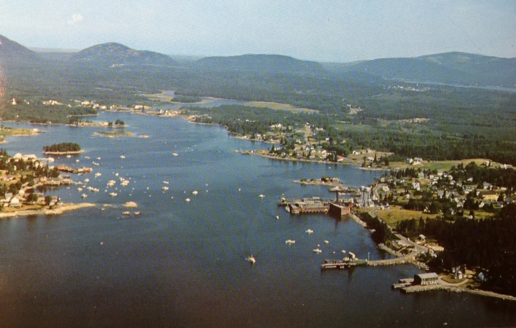
Jane began her work in cartography in the late 1970’s and early 80’s at Delorme Publishing Company in Freeport, Maine, on what she described as the “all-new-from-scratch edition of the Maine Atlas and Gazetteer.” At Delorme she also worked on a series of map guides, including Baxter State Park, the Allagash Waterway, and Moosehead Lake. Later, in addition to creating her own maps such as the Penobscot Bay to Schoodic Point map seen below,
Jane Crosen’s 1995 map “Penobscot Bay to Schoodic Point,” courtesy of Jane Crosen
Mary Jane Phillips Smith, 2021 photo by John Meader
Jane offered map sleuthing workshops. This is where she met Gus’s youngest daughter Mary Jane (MJ) Phillips Smith. MJ shared her father’s maps with Jane, and a friendship ensued:
I got talked into offering a map reading, a map sleuthing senior college class, which ended up being a four-session class, and MJ was in the class. And the last session, I invited the students to bring examples of maps that they had that they thought were cool to share with the rest of the group. And she [MJ] brought a whole portfolio of the Phillips maps.
Kevin recalled the first time he met MJ:
I came into this when I had a surprise visitor, going back ten years ago now, maybe. When Mary Jane Phillips Smith came walking up the stairs to the third floor where I used to be stationed [at the Penobscot Marine Museum], with a box of postcards. She had just seen an article or something that was about one of our Eastern [Illustrating Company] collections.^4 And she wanted to know what to do with these postcards. And, I was blown away by what she had and what she told me she had, and we made arrangements for her to donate the postcards and the slides that made them [to the Penobscot Marine Museum].
I went to pick them up [in Ellsworth] and at the end of it, she goes, now [all] I have to do is figure out what to do with all these maps. I was like, maps? And so one thing led to another and those all came here, too. And then shortly thereafter I met Cathy and then John, and [we’ve] had several projects that we've worked on together.
They've worked on some amazing articles that I've been able to pitch in a little bit. And, you know, putting a great spotlight on this [Phillips] Collection, and it's amazing, and I've been trying to get them a book deal. I've been striking out so far, but not because I haven't tried, and I'm not done trying.
Our project Postcards from Gus seemed to resonate with Jane:
I can relate to your blogs because in a way that's kind of [what I] have been doing my slide talks in the similar spirit of trying to encourage people to explore Maine's landscape, but also the history through looking at maps and looking at photos of the actual landscape and re-learning more about the history of the land use and the landscape interpretation.
Ben met MJ over a decade ago in Northeast Harbor when he and Cathy took her to lunch. As she became comfortable with Ben, she shared stories about her childhood and especially her dad. How special she felt when being chosen—instead of her four siblings—to accompany her father on plein air painting trips around Mount Desert Island. MJ described herself as “a very curious child.” She also described frequently escaping the watchful eyes of her parents and crossing the road to visit the Asticou Inn, where the cooks sometimes gave her sweet treats.
Picking up on Jane’s comment about encouraging people to explore Maine’s landscape, Ben reflected on mapmaking and the interpretation of land, in both his mapwork and Gus’s:
But his work in particular “so clearly was the work of an artist . . .because it spanned so many scales and so many media and so many use cases. [A use case is a practical application of map-making to visualize spatial data or assist decision-making.] If you make one kind of map, it doesn't mean that you're automatically going to be good at making a different kind of map. I've been both lucky and unfortunate enough to have to make a trail map that people will use in the field and hold in their hand and walk around and navigate with, and also try to do the landscape cartography, like his map of Thuya Garden.
Ben chose Gus’s 1973 map of Asticou Terraces Thuya Lodge &Thuya Garden^5 to illustrate Gus’s interpretation of the landscape.
Here are the trees in this garden and it's beautiful. It's one of my favorite maps. And it's almost like, is it a map, right? Or is it a site plan? Or is it an illustrative um? You know, it doesn't matter. It's art, right? So to me, it always comes back to that. It's like he did the large landscape reference map[s]; he did the trail map that you take with you, and it's folded, and it's double-sided [See the two Path and Road Maps of Mount Desert Island Trails below]; he’s done paintings and wall art.
Gus initially honed his cartography skills while working with his older brother Luther, a draftsman with an architecture degree from MIT. Luther’s map-making style was largely pictorial. Luther worked as a draftsman for several years before he began shooting photos for postcards and drawing maps which he sold to businesses throughout Maine. He accepted commissions from sporting camps and other businesses that wanted to advertise. Gus worked part time for Luther and learned different aspects of Luther’s map and postcard business, beginning with hand-coloring Luther’s maps in the early 1940s and eventually making maps of his own. After Luther’s death in 1960, Gus inherited the business and became its sole proprietor. As cartographic printing processes evolved and tourists sought new and different types of maps and postcards, Gus adapted his style to keep up with the times.
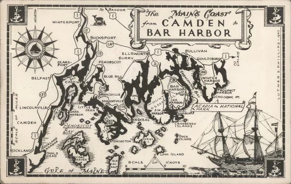
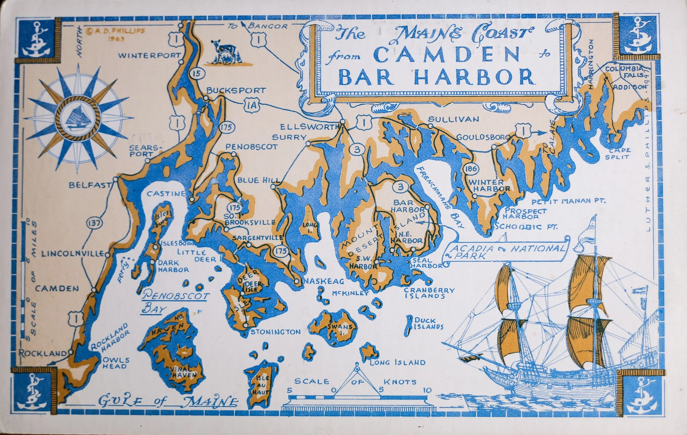
Luther’s 1943 map of “The Maine Coast from Camden to Bar Harbor” and Gus’s redesign of the same map in 1963
Jane and Ben discussed the evolution of Gus’s mapmaking style, after initially comparing it to Luther’s.
Ben remarked:
Whereas again Luther had a lot of really nice maps, but most of them were kind of that mesoscale [containing images pertinent to the region shown, ie. pictorial]. Here’s a region with illustrative figures on it, and you'd put it on your wall. And that’s cool, but to me, it's not as dynamic as what we see out of Gus’s work.
Jane chimed in:
I really saw a transition from where Gus picked up Luther's mapmaking style, which really is kind of reminiscent of Ruth Rhoads Lepper [Gardner].You know, the historical, looking like an old, an antique map, with all the little details and stuff. Gus kind of combined it with more of a sense of the landscape.
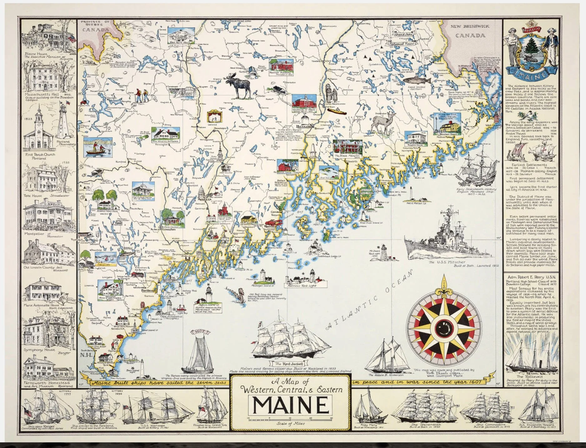
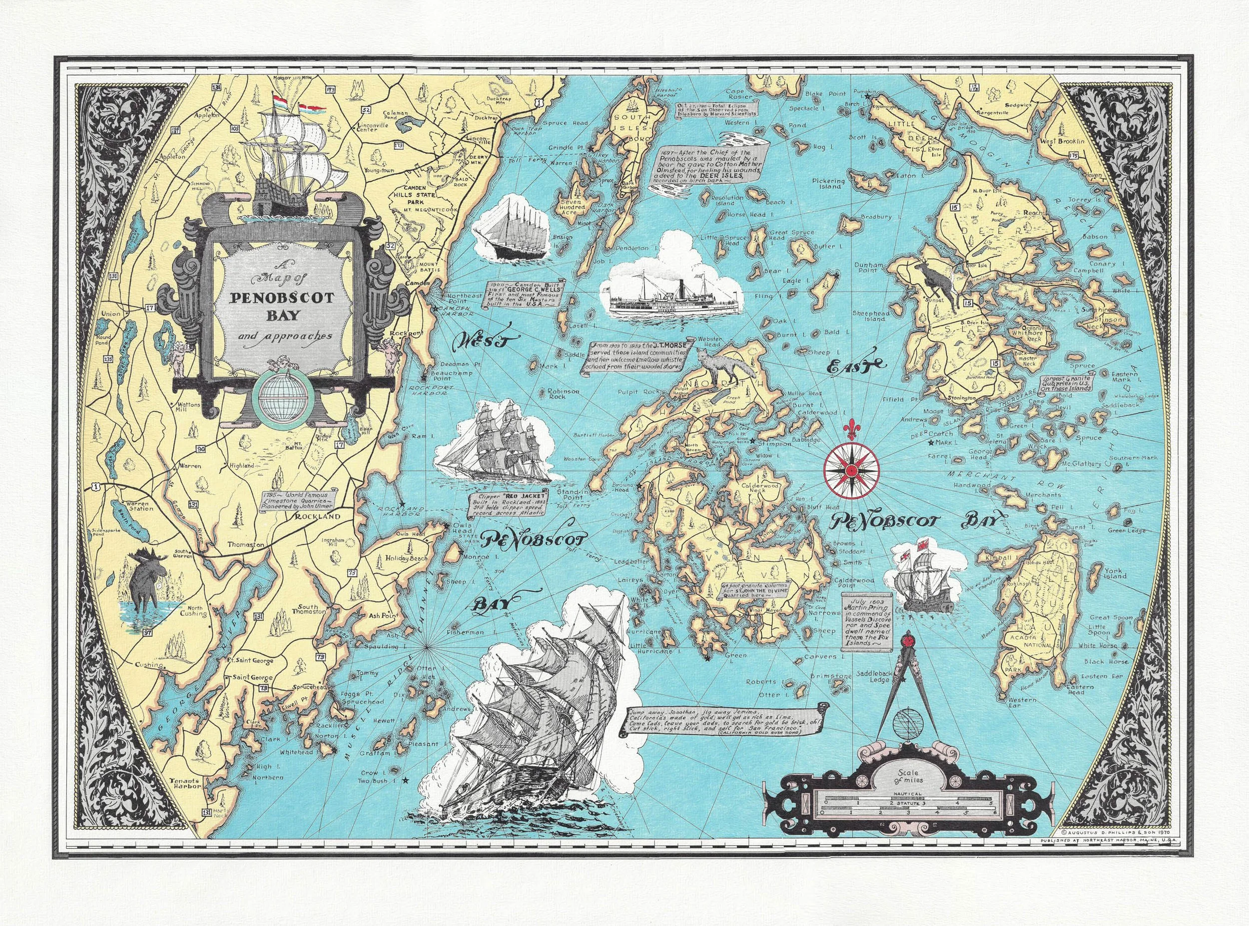
3 Maps: Luther Phillips’s 1951 “Maine Coast;” Ruth Rhoads Lepper’s 1952 “Western, Central, and Eastern Maine;” Gus Phillips’s 1970 “Penobscot Bay”
He's more of a landscape artist, but also he sort of transitioned the map style and genre really into more of a recreational map. . . .I really appreciate his whole series of the recreational maps of the North Woods with the little red symbols—I mean he was kind of showing Delorme how it’s done—with the little red symbols showing recreational boat launches and fishing spots and all of that, but also done in a very well drafted style.
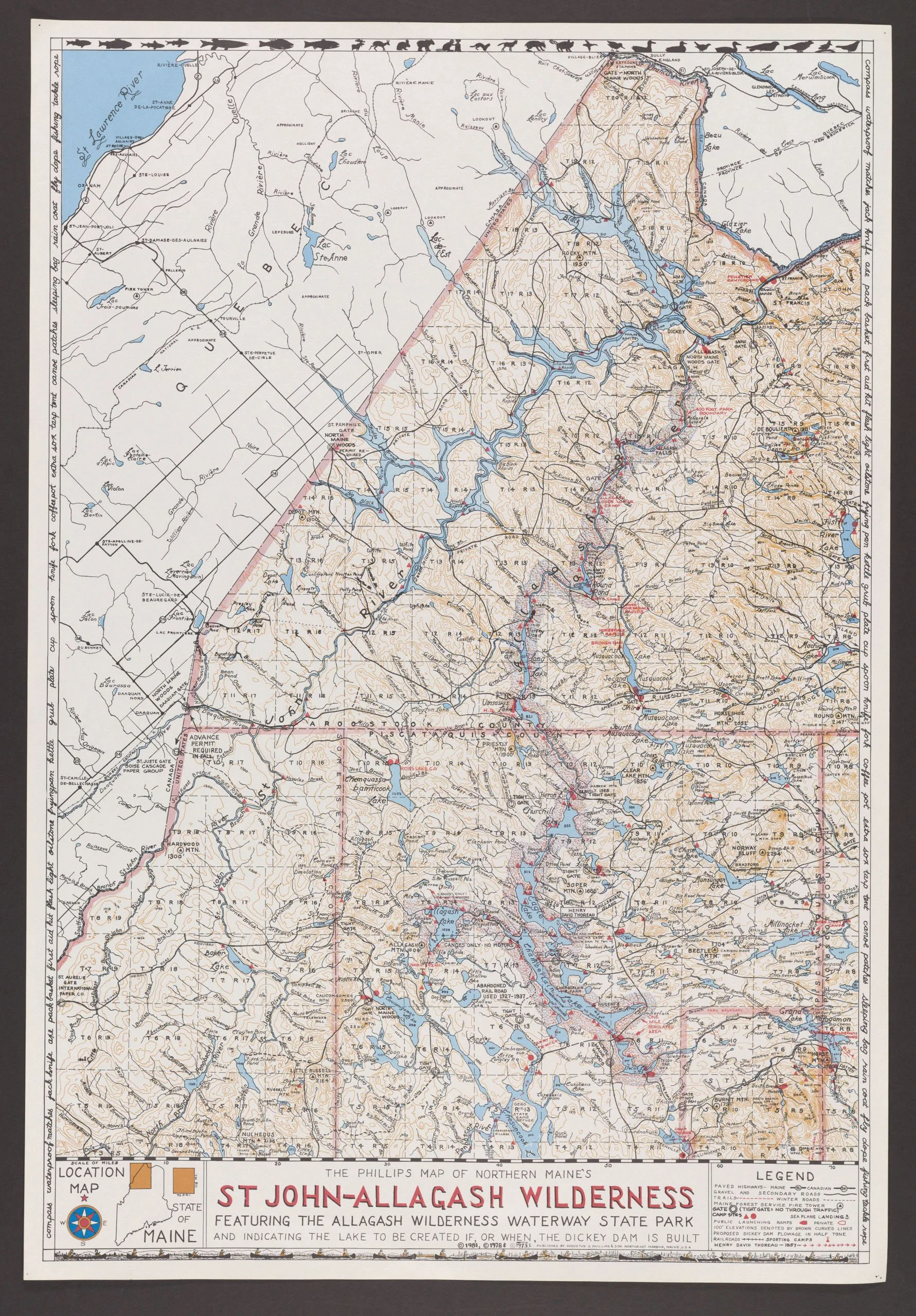
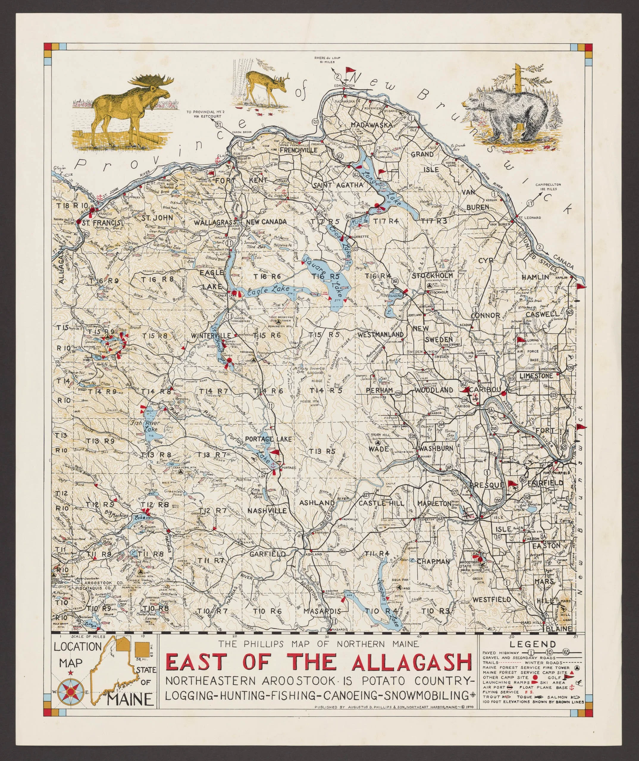
Gus’s 1973 “St John-Allagash Wilderness” map and his 1970 “East Of The Allagash” map
. . . . kind of reminds me of the AMC [Appalachian Mountain Club] maps, the trail maps with the contour lines and the neat lettering. But I'd love to hear more about what Gus's techniques were.
John replied: And then we move to these trail maps which, like you said, remind me of the AMC trail maps sort of things. He had one of each side of the island, and these were meant to be used to navigate trails from my understanding, right?”^6
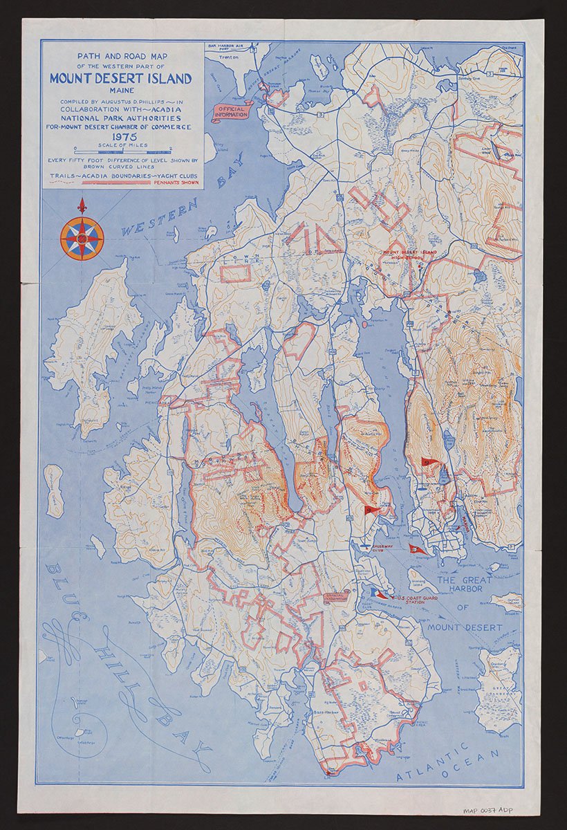
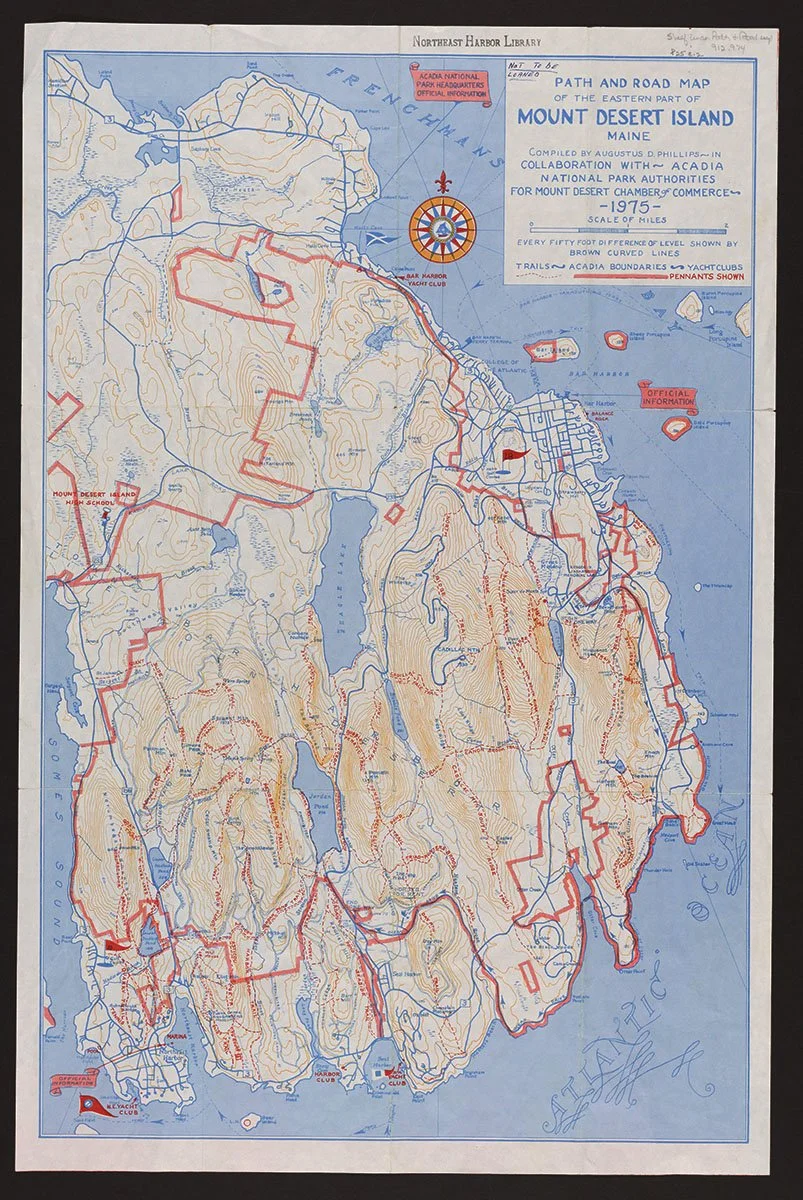
Gus’s 1975 Path and Road Maps of Mount Desert Island
And then of course you move to this [map-Sunrise on Acadia] which to me is a blend from a map to a painting….But you're starting to blur the lines between cartography and a landscape painting. And I always find those edges where things don’t clearly fit into one category or the other really fascinating places. I’m curious how he moved from one to the other? And whether he moved from one form to the other or he mixed them up? ….Or whether one evolved into the other? I don’t have the answers to that, but I’m curious to everyone’s thoughts on those types of transitions and different styles. Because I could see how someone could be really good at the AMC-type map and not be able to do something like this at all.
Jane responded with similar questions: Were his Sunrise on Acadia-style maps one-offs where he hand-lettered right on top of the painting with ink? Was there any way to make corrections?”
Gus’s 1966 “Sunrise on Acadia” map, photo taken of the original at the Northeast Harbor Public Library, Northeast Harbor, Maine, by John Meader
Everyone agreed that Gus’s landscape maps required quite different skills than the more draftsman-like rec maps. As Cathy recalled:
Yeah, different kinds of maps at different times, but then a commission was different from what he was going to self-publish and sell.
Ben replied:
That Casco Bay one to me has always been interesting because it seems like a singleton. I don’t think he did any other obliques that were pen based like this, but I could be wrong.
Gus’s 1971 “Aerial View—Casco Bay, Maine to the Longfellow—Blue Mountains” map
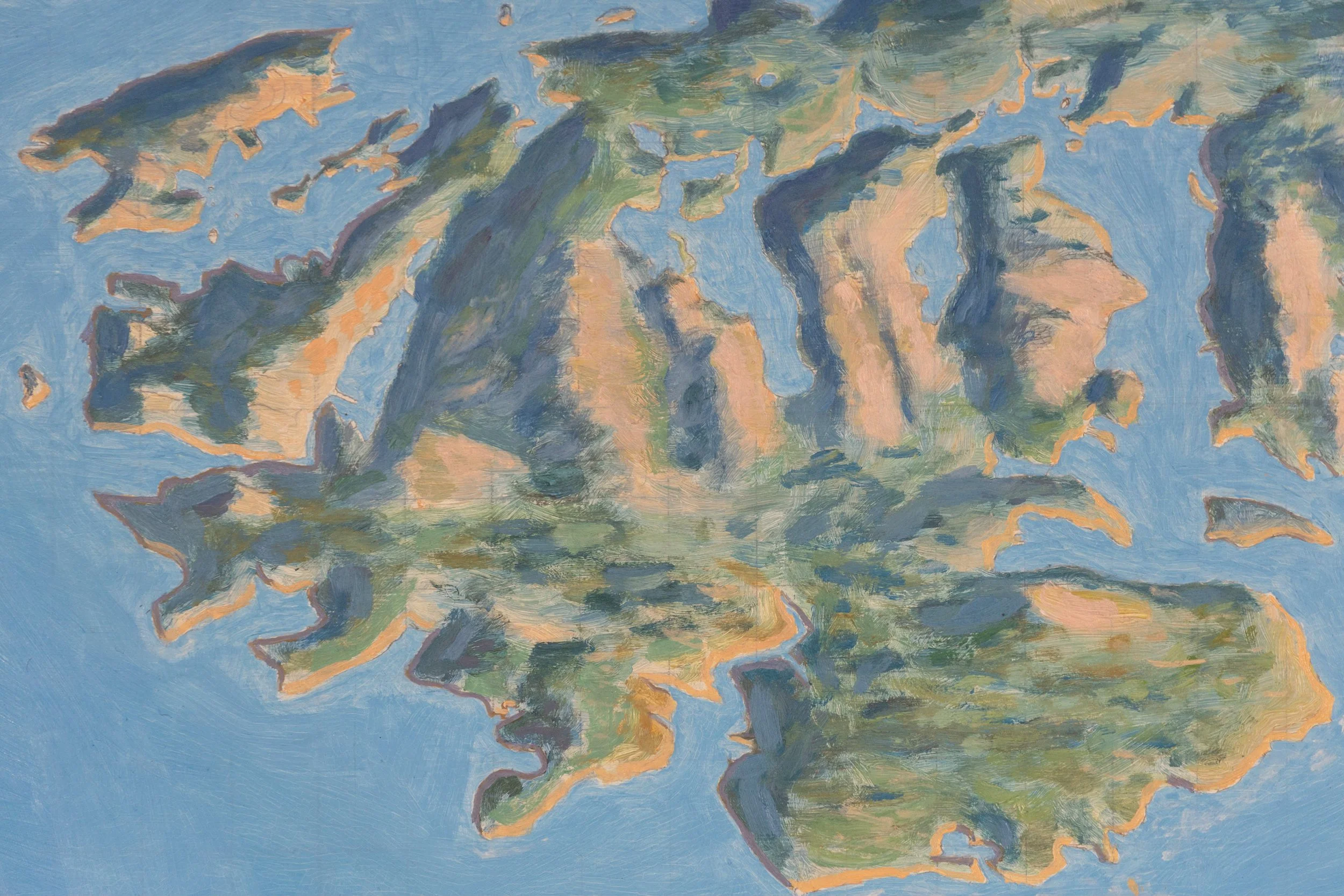
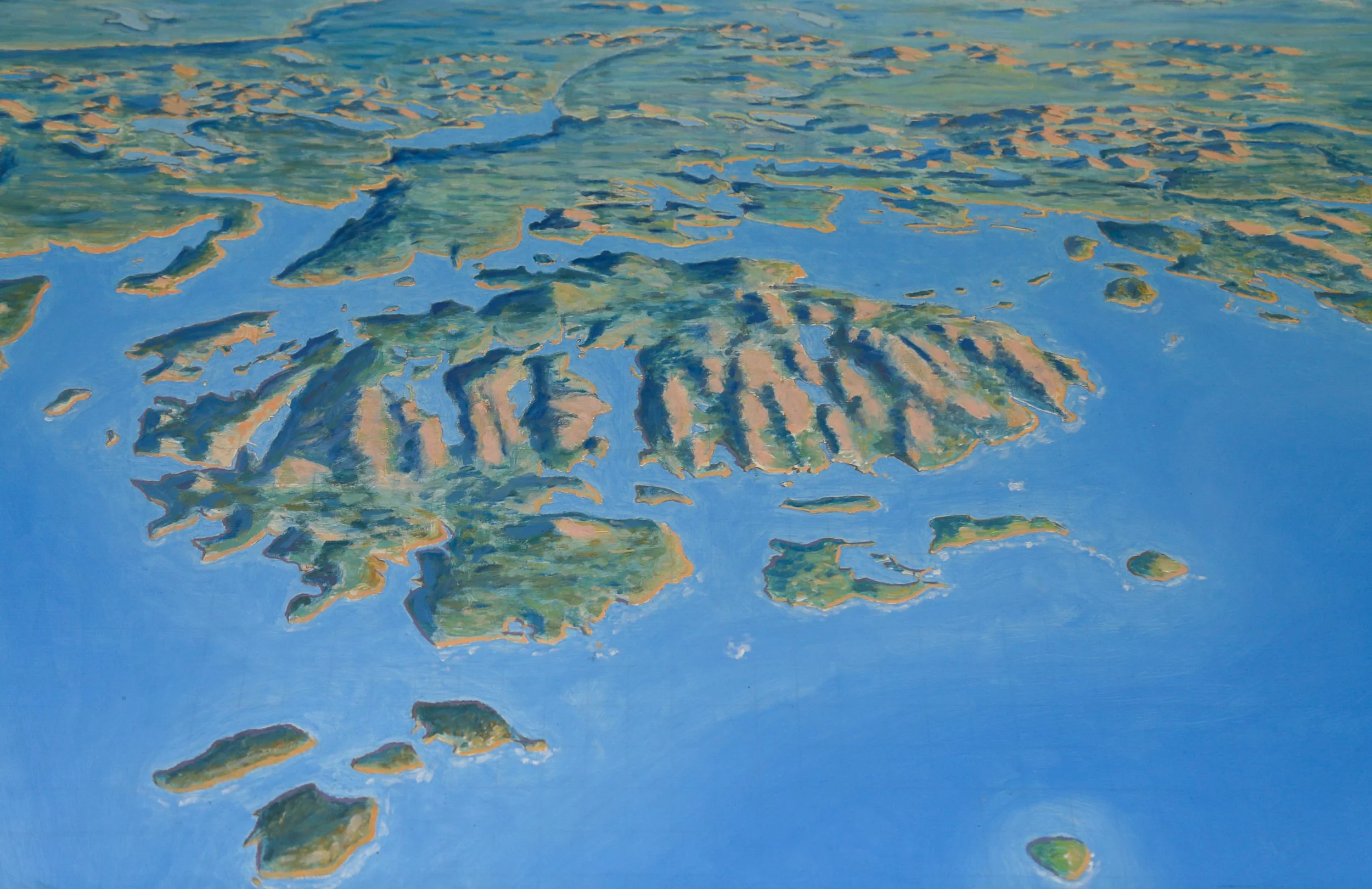
This is a highly imaginative [view] like from the ocean looking at a much broader landscape, looking into the mountains. You know even with, not the Sunrise on Acadia, but the one that’s the painting where it shows from the ocean, looking over Mount Desert Island, I think it’s like MDI to Katahdin or something like that. And you know that he spent so much time in an airplane with photographing things that it was like, he was never at this elevation looking out of an airplane at a crisp day, but he was just imagining how beautiful Maine would look, you know, if you could see Cadillac and Katahdin in the same view. And to me that’s kind of like he’s making a picture in his head of the beautiful landscape that he wants to imagine and then rendering it, rather than like, we’re making a 3-D map, let’s make sure it’s all registered and correct and geographically sound. It’s like, I’m sure that the majority of these features are, at least the concept of them probably correct. It’s both a real and imagined landscape is how it feels at least to me.
Gus’s 1975 unfinished painting of an aerial oblique view of Mount Desert Island, courtesy of the Northeast Harbor Library, Northeast Harbor Maine, photo by John Meader
His soul was in painting, and so whenever we get to see the painted maps, that’s his creative flourish one hundred percent. But then because he relied on it [creating and selling maps of Maine] more for income than his brother [Luther] did, at least from what we can see, that when he started to systematically cover the state with these large-scale recreation maps, I think it was in the seventies? But it was like pre-Delorme, before the Delorme maps came out, which meant that having an overview of where all the camp sites were and all the boat launches [was helpful], like we kind of take it for granted [nowadays].
When we look at Gus’s aerial postcards of Mount Desert Island, of which there are many, and compare them to Gus’s painting of Mount Desert Island from above, it’s not hard to imagine that the postcards were a major source of his inspiration for the painting.
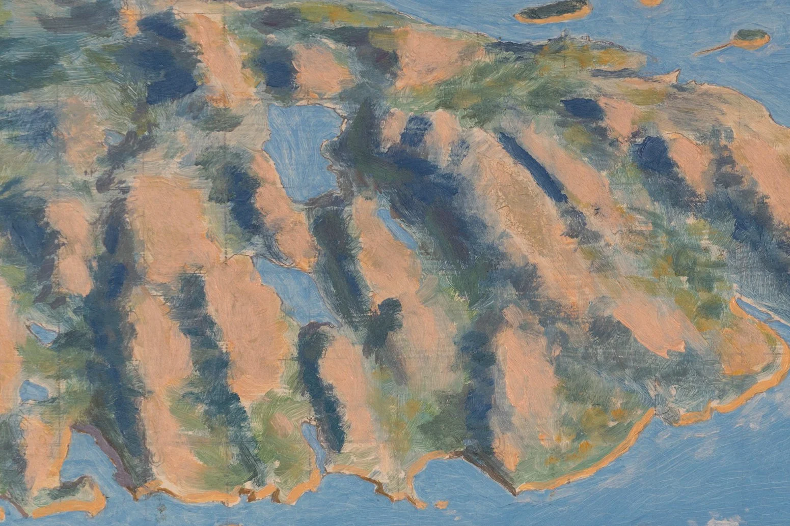
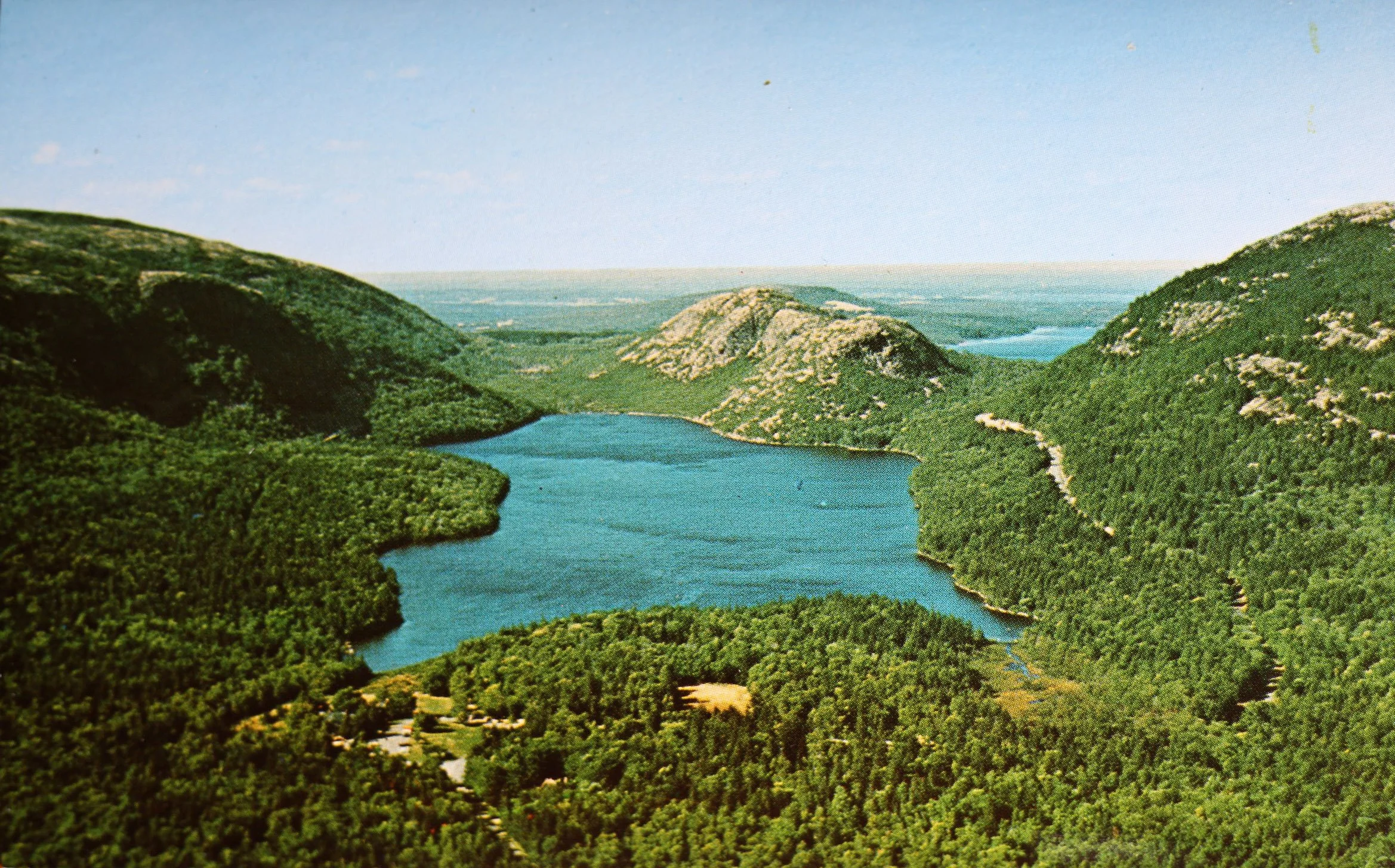
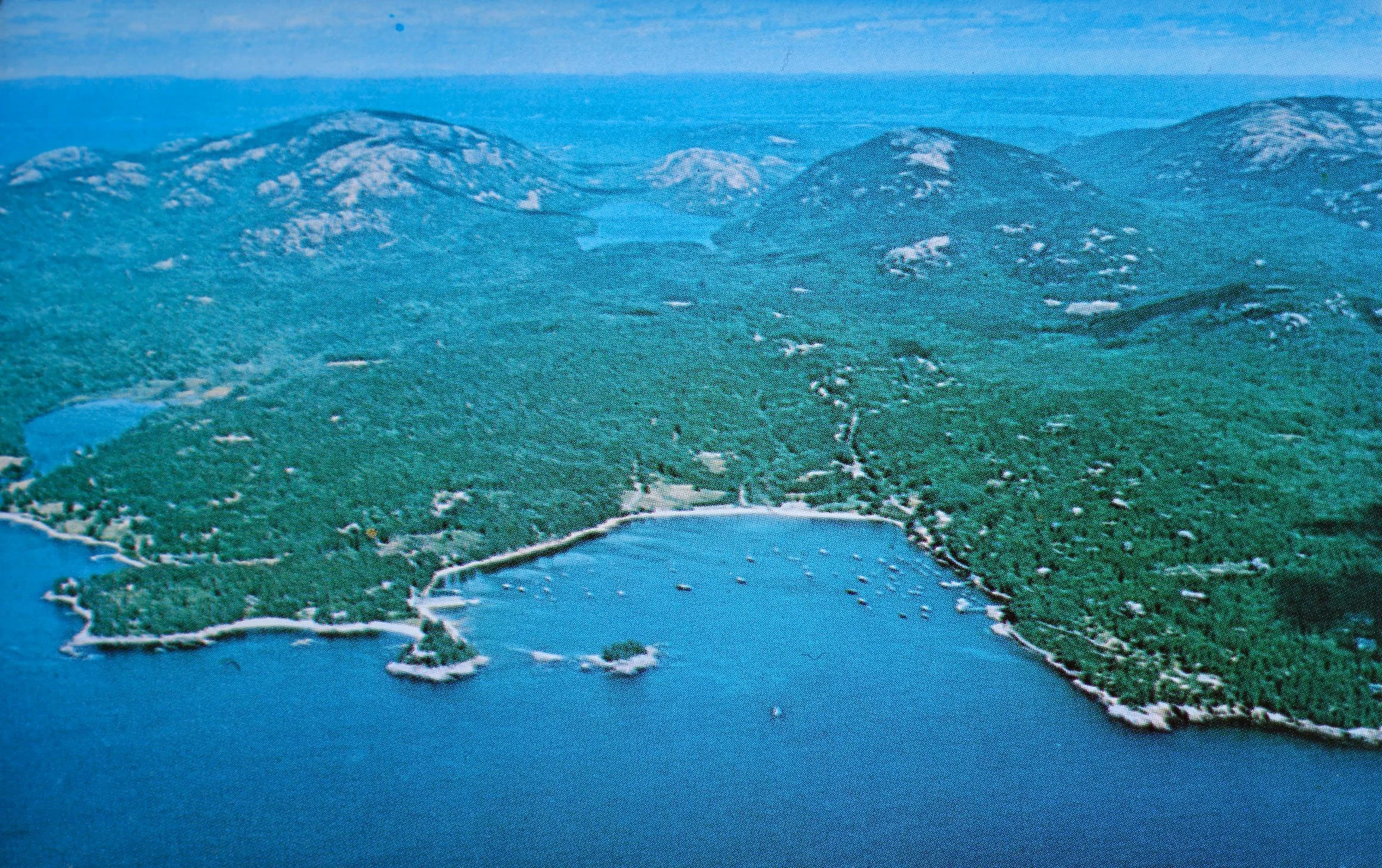
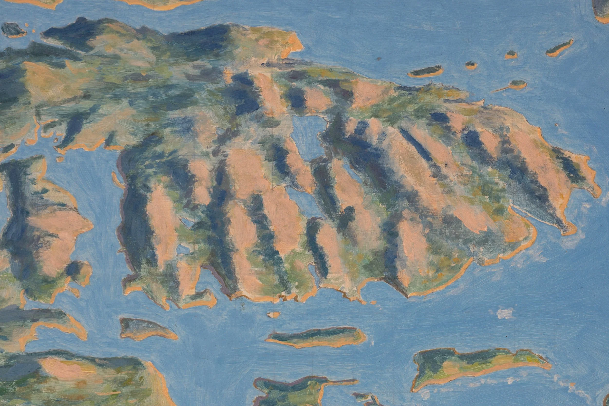
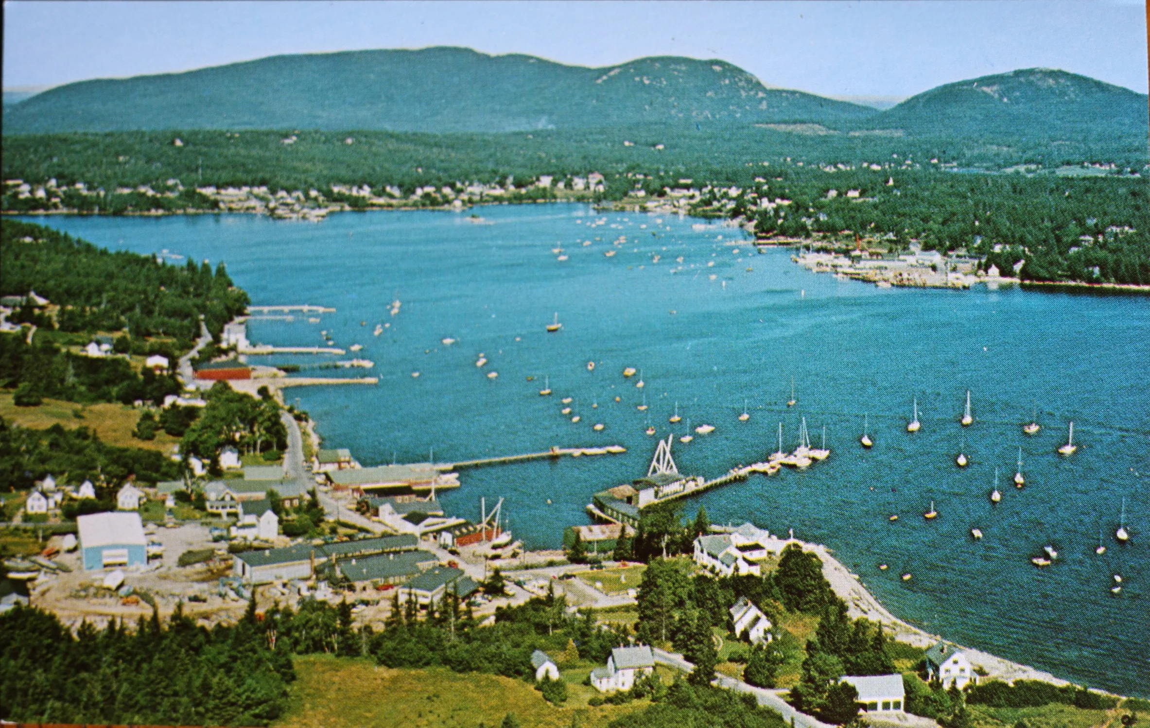
Montage of Gus’s Mount Desert Island aerial postcards compared to detailed images of his unfinished Mount Desert Island painting. Postcards from upper left: Bar Harbor #46, Baker Island Light #68, Northeast Harbor #76, Acadia Headlands #149, Jordan Pond #444, Seal Harbor #428, Manset #155, Bass Harbor #168.
Pondering the growth of tourism in Maine and an expanded market not only for way-finding material but also for Maine memorabilia, Ben commented on the second aspect of Gus’s enterprise, “There were some map postcards as well.”
Indeed, as tourism rapidly grew in Maine from the 1960s into the 1970s, Gus did expand the postcard segment of his business that Luther had begun decades earlier. Gus initially updated and reproduced a few of Luther’s map postcards. The majority of Luther’s picture postcards had been printed in black and white. Gus began to shoot his own photos, eventually building up an inventory of hundreds of color postcards. Was Gus singing lines from Paul Simon’s Kodachrome, you know, “I got a Nikon camera, I love to take a photograph,” as he flew over Maine’s waters and small towns in 1973? If so, only his bush pilot and Gus know for sure.
Organizing his STATE ‘O MAINE POST CARDS order form into categories, he informed the buyer, “Cards are arranged geographically, so title as well as number must be indicated on the order.” As the years went by, Gus added new cards and retired others. Although the order sheets reflected those changes, the primary categories remained the same: Maine Coast Light Houses, Inland, Map Cards, Wild Life, and The Maine Coast.
Kevin put Gus’s postcard business into historical perspective, mentioning the photo postcards produced by the Eastern Illustrating and Publishing Company of Belfast, Maine:
We're talking primarily about the sixties and the seventies. I would say Eastern was winding down at that point, or at least they went through a lull before they switched to making color, and then they became kind of the generic postcards. But they by no means were the only game in town. And just like Gus’s would not have been the only game in town. There would've been a bunch of competition and a very small profit margin. I mean, you're selling an item that, you know, you might make a quarter on, and you're selling them in groups of a hundred or 1500 or whatever, you know, a number. But there's the outlay that you have to pay to have them printed. Then all this driving around, and he was selling them face to face. There was no online ordering at that point in time. It had to be, in my mind, a labor of love as much as anything. Eastern also did map postcards. They were literally just photographing out of the gazetteer or something like that, just a section of a page.
Jane surmised, “As a map business person, it helps to have more products to offer. Probably the postcards helped sell the maps.”
Our conversation returned several times to the observation that Gus expressed his artistry in numerous ways. He was a painter, a draftsman, a photographer, a wood carver, and a cartographer. He frequently blended those skills, blurring boundaries among the various disciplines. John noted the connection among all of Gus’s forms of artistry:
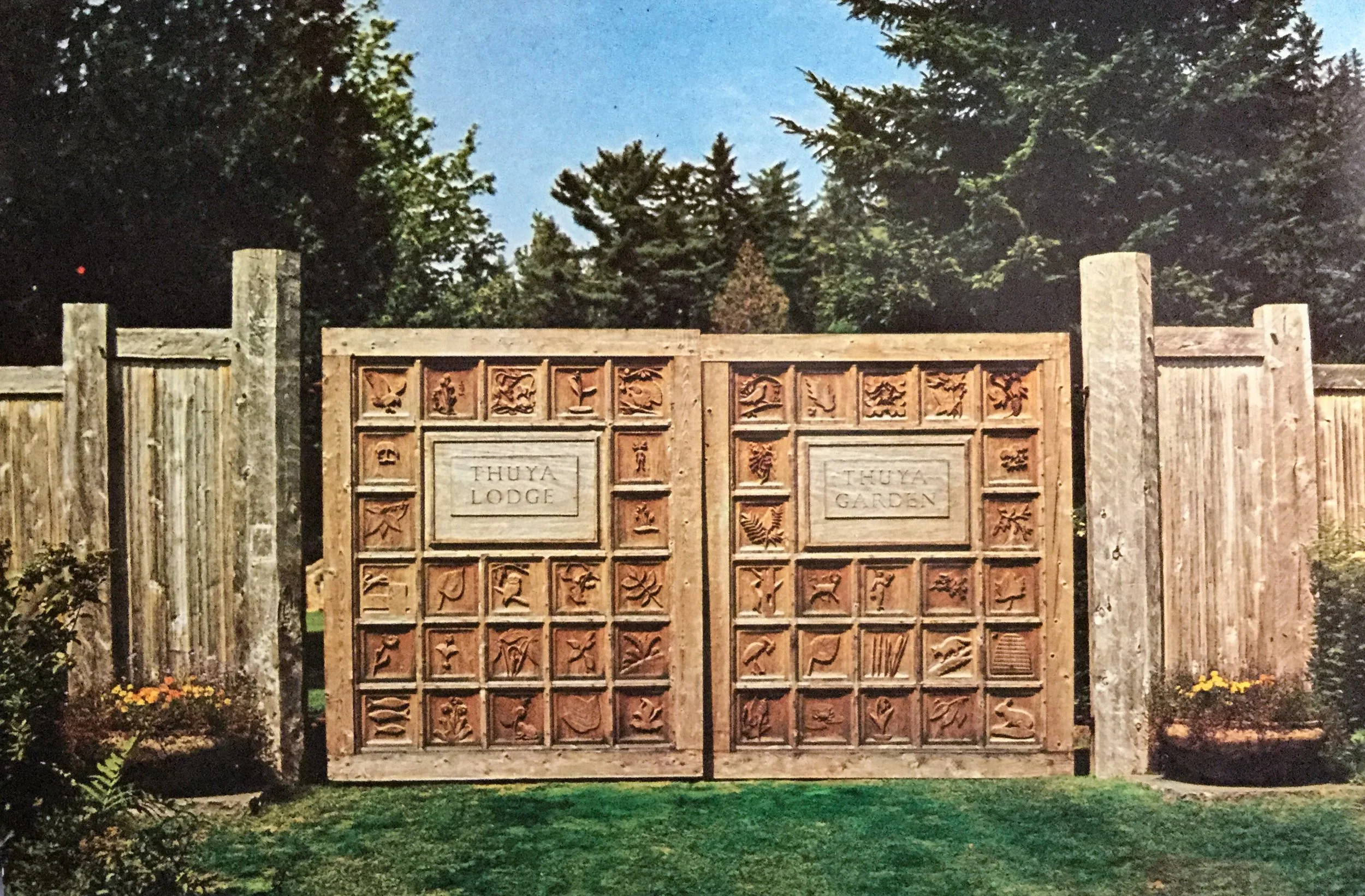
At a glance Gus’s various skills seem diverse and unrelated, yet when we look closer we find a connection between his photography and his cartography. If we dive deeper, even his carving skills, so evident in the Thuya Garden Entrance Gates which illustrate vignettes of flora and fauna of the area, we find that he frequently uses similar motifs on many of his maps. All these artistic skills, in the end, relate to Gus’s intimate relationship with his island home, the environment, and his love of Maine. A true artist.
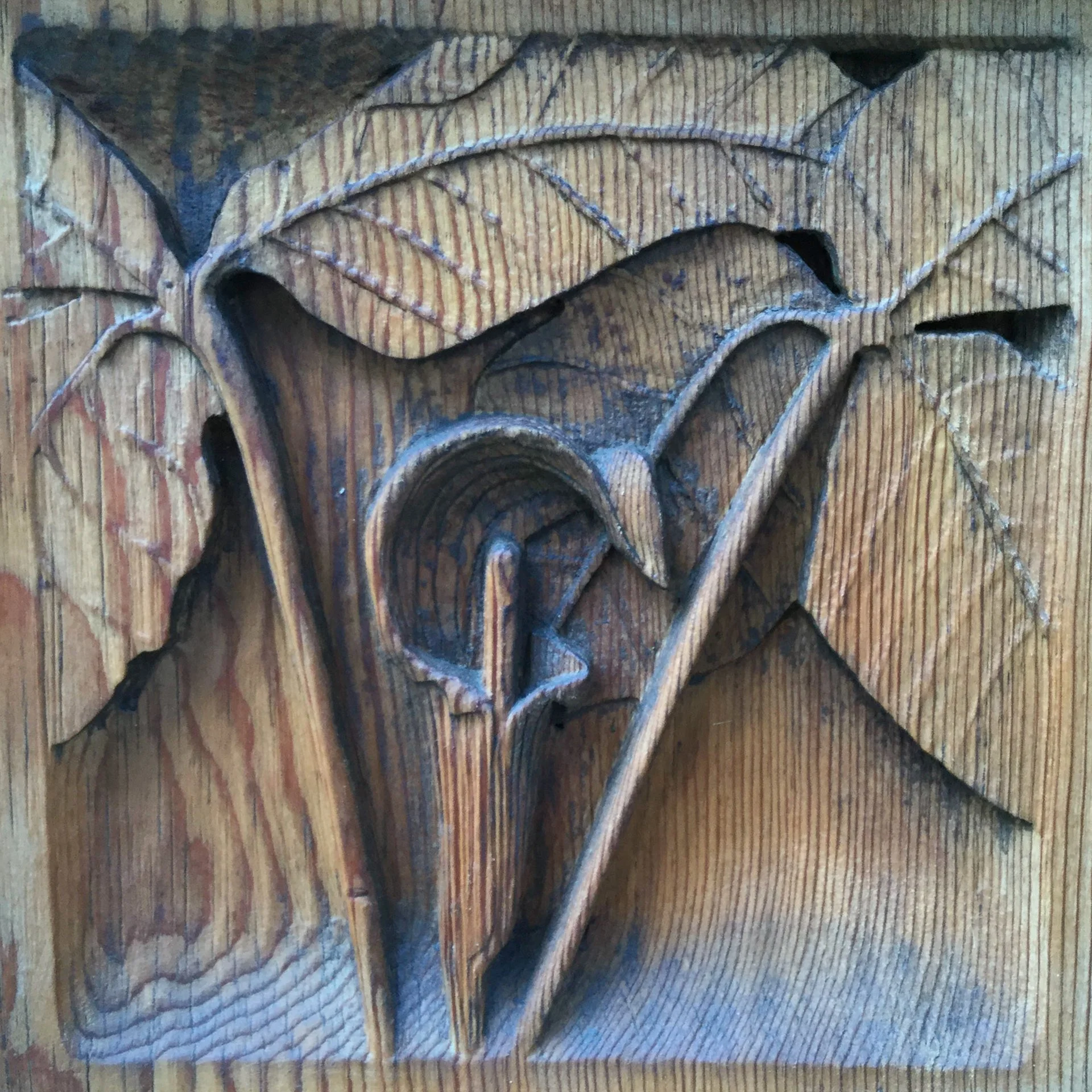
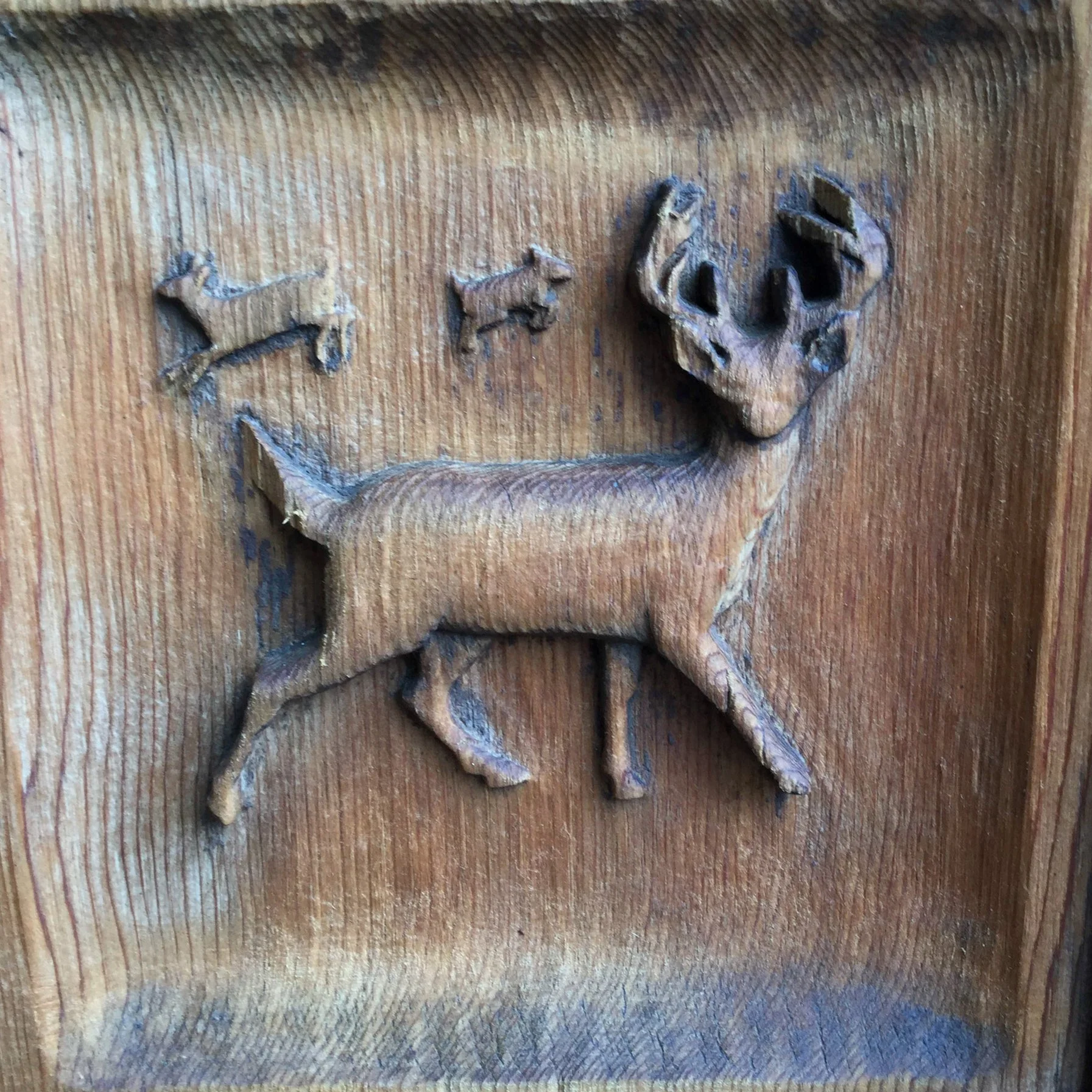
Details of two of Gus’s carvings for the Thuya Garden Gates: Jack-in-the-Pulpit, and white-tailed deer.
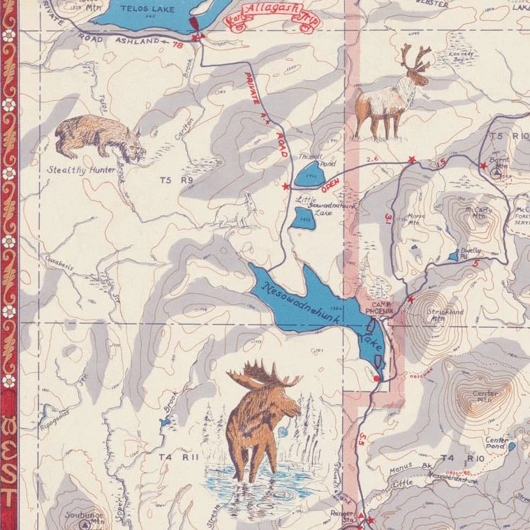
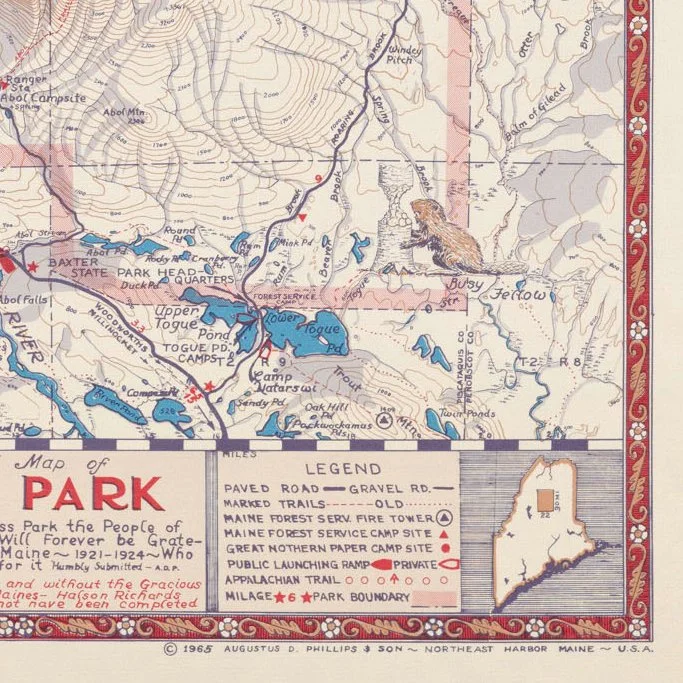
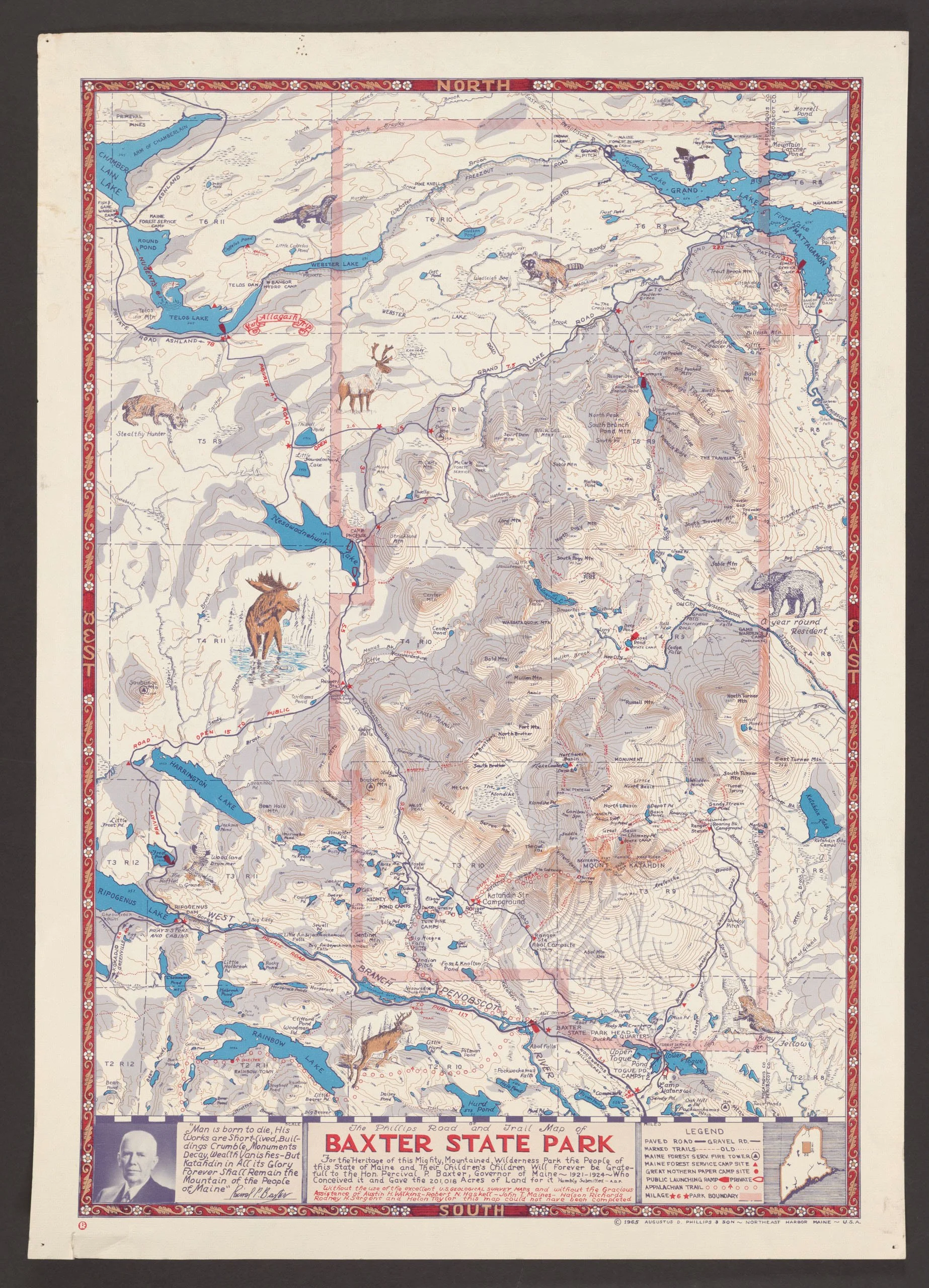
Animal figures and floral boundary designs are familiar features on Gus’s pictorial maps, such as the moose, bobcat, caribou, beaver, and floral designs seen on the detailed images of his 1965 map of Baxter State Park. See below the full images of Thuya Gates on Gus’s 1962 postcard and the Baxter State Park Map.
Cathy responded to all these thoughts about her grandfather with fond memories of him from her childhood:
A portrait of Gus Phillips
From the time I was little—I think my grandfather, he was such an extraordinary man, and so creative with everything he did. In the winter time when he was working in his big dining room, on that huge table, he actually would let me use some of his Peerless watercolors,^7 which came in a paper folder. And I think it's fabric paper that's infused with color. And so you clip a little piece of that off and you put it in water, and you can control the intensity of the color. He let me try those. And then I can remember my parents getting me a Christmas gift that was a [set of] Peerless watercolors. So, he was just so much a part of my childhood, and I think I took everything about him for granted —his creativity, his working in his workshop and all the cedar wood shavings [from carving the Thuya Garden gates and other projects], when my brother and I would go in and, oh, the smell was just incredible. And so some part of me always knew I'd do a project like this [Postcards from Gus] I think. At Colby I majored both in art and in English. But it wasn't until I had retired from teaching, really, that I had time to slow down, and I connected with my aunt about my grandfather's maps.
And then everything seemed to fall into place and we met Kevin, and then Ben and I worked [with the Phillips Collection at the Penobscot Marine Museum], and then we added John. I am just finding the more I do research and the more I uncover, the more there is to uncover about my grandfather and Luther, and just the whole Phillips legacy.
I'm just so delighted that I got to know my aunt so well because initially she and my mom did not get along. They both had strong personalities, and so we didn't see her a lot for many years. But as soon as I reconnected with my aunt, I could see my father so clearly in her face. I mean she's just such a Phillips. We sat for hours, so many hours. I think it was probably five years that she and I had together, and [I] was working at Thuya on the island and staying with her in the summers was just incredible. I mean we passed hours and hours and hours just talking and sharing what we remembered.
She, of course, had all kinds of stories. We travelled a little bit together, I mean we went to Katahdin and Baxter and stayed two or three nights. And I could tell you that when we were organizing the camp where we stayed, for some reason she couldn't find where to put the dish drainer, and it was one of those rubberized dish drainers. And so she stuck it in the oven. And we didn't use the oven while we were there, but the camp was owned by the people from whom I was renting in New Harbor, Maine. And when they went up a couple months later and turned on the oven because they wanted to cook something for dinner, there was a terrible smell. And, indeed, the dish drainer was still in the oven.
I'm loving doing this [research and project], and I so appreciate everyone that's contributing because it's a group effort. I mean, the Phillips Gang is really important. Again, I took so much for granted, I mean my favorite places are the woods right beyond my grandparents' house. We would just go up the side of Asticou Hill and play. It's all, it’s all just a part of me.
We’ll conclude the conversation here, with a sincere thank you to Kevin, Ben, and Jane for sharing their expertise with us. We’re already looking forward to the next time we gather to chat about Gus!
“The fundamental law of human beings is interdependence. A person is a person through other persons.” - Desmond Tutu
Recommendations for further reading and exploration:
1 Kevin Johnson, Photo Archivist at Penobscot Marine Museum in Searsport, Maine, shares the story behind the collaborative effort to bring his newest book, Boothbay Now and Then: New and Historic Images of the Boothbay Peninsula, to publication, in Penobscot Marine Museum's March 2026 Newsletter article “THAT WAS THEN-THIS IS NOW.” penobscotmarinemuseum.org/march-2026-newsletter/. Kevin also co-authors Maine on Glass: The Early Twentieth Century in Glass Plate Photography.
2 Benjamin Meader examines the lives and the cartographic techniques of Gus and his older brother Luther in his article in Cartographic Perspectives: “Drawing Maine: The Pictorial Maps of the Phillips Brothers,” cartographicperspectives.org/index.php/journal/article/view/1877/2243.
3 Jane Crosen invites an exploration of her art at Mapmaker Jane Crosen www.mainemapmaker.com/ In the subsection titled “Meet the Mapmaker,” she states, “When not mapmaking and editing—or writing, cooking, playing with colors and fibers—you’ll find me hiking and paddling, snowshoeing and benchmark hunting, exploring the woods, streams, and ponds around Hancock County and the Downeast lakes.” www.mainemapmaker.com/about_the_artist.html.
4 The Eastern Illustrating & Publishing Company Collection is housed at Penobscot Marine Museum in Searsport. Find the Eastern Illustrating Company’s collection at penobscotmarinemuseum.org/eastern-illustrating-publishing-company/.
5 Asticou Terraces Thuya Lodge & Thuya Garden map: Gus’s large, original painted map hangs to the left of the entrance door at Thuya Lodge, located at Thuya Garden in Northeast Harbor, Maine.
6 East side of Mount Desert and West Side of Mount Desert maps: Commissioned in 1964 to create an updated and revised map of the Mount Desert Island trail system, Gus produced the East Side and West Side maps. Their inclusion in a book for the Olmsted Center, is one that Jane Crosen edited: Pathmakers: Cultural Landscape Report For The Historic Hiking Trail System Of Mount Desert Island. Acadia National Park, Maine, History, Existing Conditions, and Analysis. Gus’s maps appear on pages 157-158.
7 Peerless Watercolors are still available: https://peerlesscolorlabs.com/products/peerless-watercolor-complete-edition-set-of-15-colors.
Special thanks:
To the Penobscot Marine Museum and Photo Archivist Kevin Johnson for image use, preserving the Phillips Collection, believing in this project, and his continued support; to Ben Meader, whose initial and sustained contributions to all facets of this project remain integral to its success; to Jane Crosen, a kindred spirit, whose enthusiasm and support energize and enlighten us; to Northeast Harbor Library for displaying Gus’s work and support of this project; to Mary Jane Phillips Smith, Gus’s daughter, for championing her father’s work and for sharing Phillips family stories and history with all of us; and to John Meader for photography.
Partners for the Postcards from Gus blog:
