

Postcards from Gus:
A modern travelogue through Maine’s past.
What happens when a cartographer, a writer, and a photographer walk into a museum?
#14 A Conversation about Gus
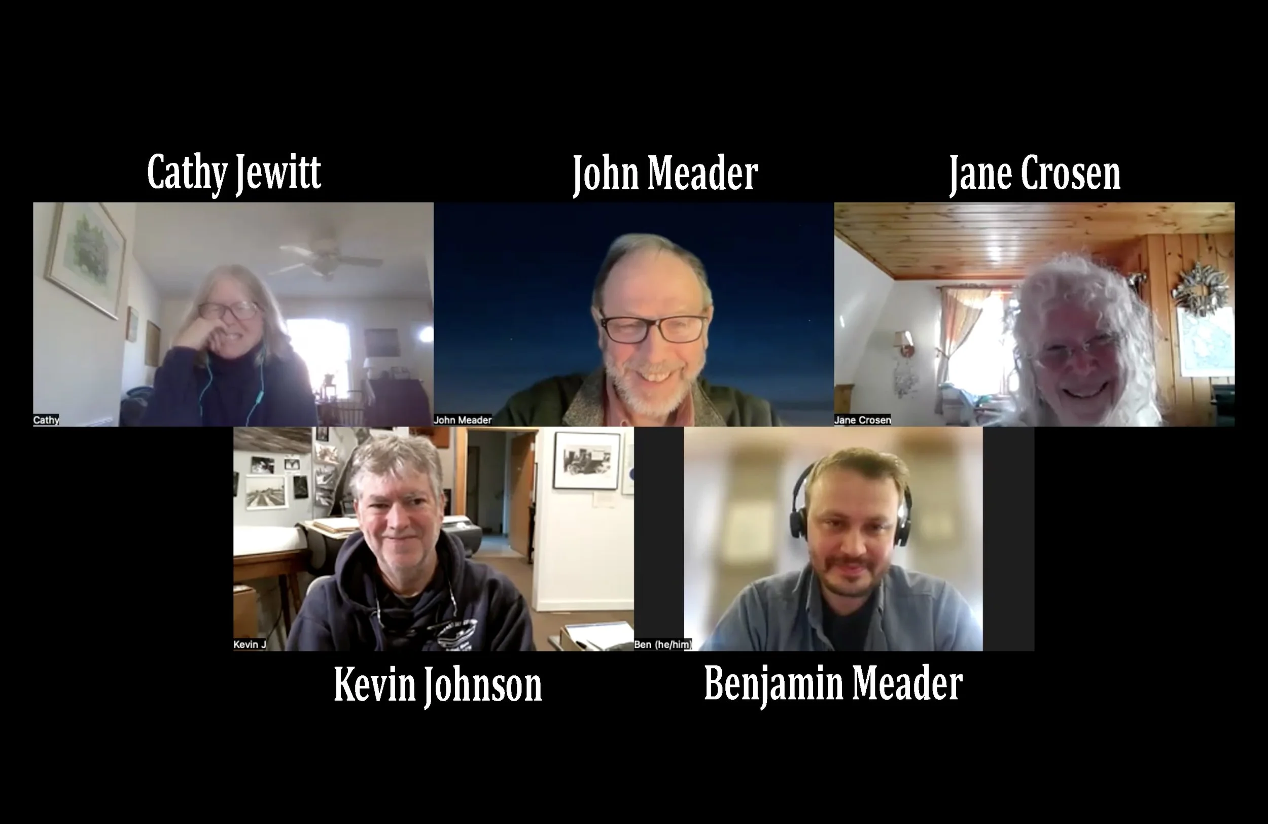
As John and I continue to explore the art and life of Gus Phillips, we frequently dig deeper into a specific topic by asking others to share their expertise with us. Wanting to better understand Gus’s mapmaking, in January we chatted for an hour with Kevin Johnson, Ben Meader, and Jane Crosen.

#13 Greetings from Mount Desert Island
It’s 1967 and Gus is shooting photos of Mount Desert Island (MDI) from the air, land, and sea. After the film is developed, and the frames are mounted as individual slides, Gus decides which ones he will send to be printed as postcards.

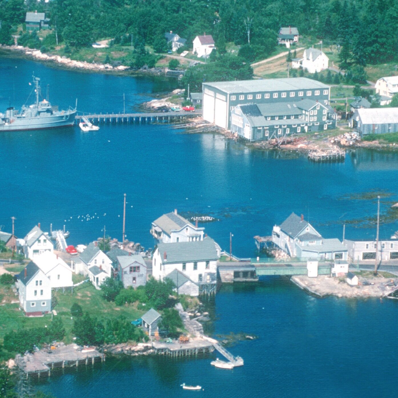
#12 Welcome to Maine
As young men, Luther and his younger brother Gus combined their desire to make art with their need to make a living. Drawing, painting, and photographing Maine, the Phillips brothers created and sold maps and postcards of the state. The story of their success is interwoven with the development of Maine’s tourist industry during the first three quarters of the twentieth century.

#11 Beans, Ballads, and Caulk Boots
It would have been difficult to find a lumberman working in the Maine North Woods during the early twentieth century who didn’t express an opinion about baked beans. The beans helped to provide protein and part of the roughly 8,000 calorie diet the men consumed daily.

#10-Buoyed in Boothbay Harbor
Early one June morning in Boothbay Harbor, a town located on a peninsula in midcoast Maine, Gus Phillips finished his sausage and eggs, kissed his wife Mary good-bye, and headed to work.

#9 - Mapping Maine’s Total Solar Eclipses-60 years apart
Using his art and cartography skills, Gus worked over the winter of 1962-63 creating a new postcard to celebrate that summer’s upcoming solar eclipse.

#8 - Greenville
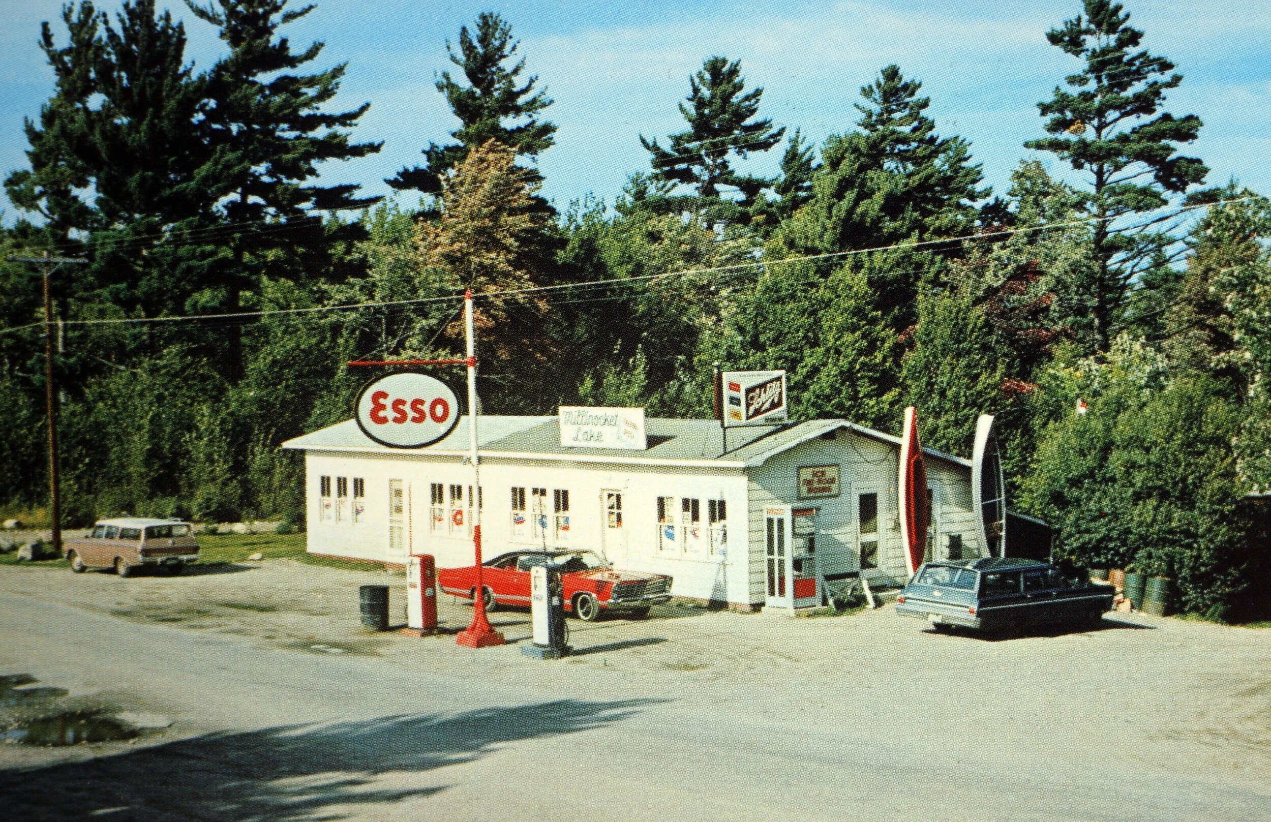
On a sunny day in August 1962, after an early breakfast at home in Northeast Harbor, Gus loads up the Rambler with postcards and maps and heads to Greenville, a town on the southern edge of Maine’s Moosehead Lake.

#07 - Thuya
When I was little, I often visited my grandparents in Asticou, which is part of the village of Northeast Harbor, Maine. In the evenings, often we would walk to a secluded and magical place. Following a path that led us through the woods and up Asticou Hill, we entered Thuya Garden.

#06 - Hijinks & a High School Romance
Author Cathy Jewitt explores the history and stories behind her grandfather Gus's formative years. His time at Hebron Academy and courtship of Mary Craig are set against the backdrop of other major changes at home and abroad.
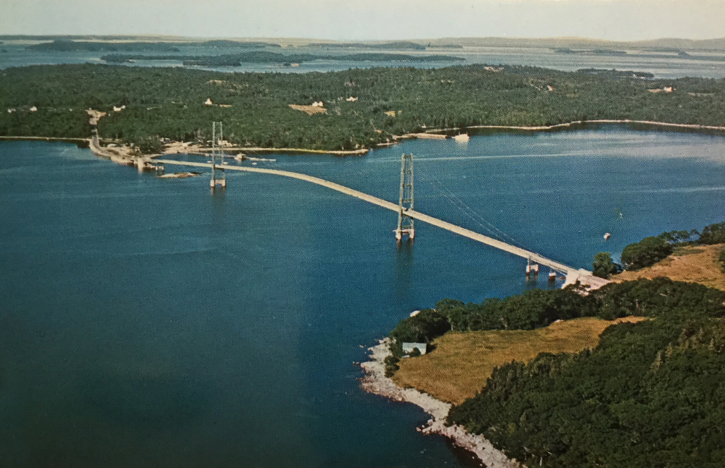
#05 - Bridging Time: Deer Isle & Eggemoggin Reach
Cathy Jewitt and John Meader explore the history of Deer Isle and Eggemoggin Reach with Augustus Phillips, downeast Maine's cartographer, photographer, and painter.

#04 - Capturing the Fort
Popham has changed quite a bit over the course of 50 years. The locals tell all. Check out the fourth article in the "Postcards from Gus" blog series.
#03 - The North Woods, the Road, & a Rambler
Gus hits the road in 1963 to sell postcards all over Maine's interior in preparation of the total eclipse that summer—enjoy as we look at some maps, postcards, beautiful pictures, and history.
#02 - Breaking the Water
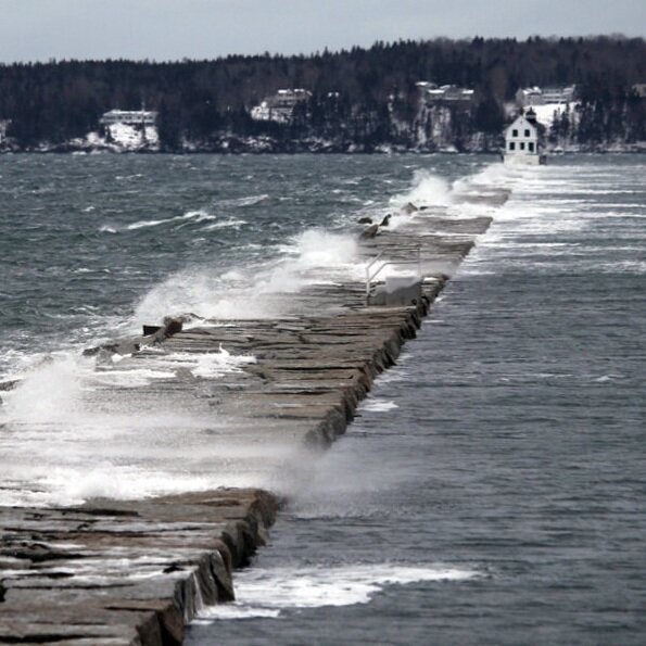
Second post on change along Maine’s coast. Take a look at lighthouses from the perspective of father and son, a century apart. Fred is in his 20s in 1873, his son Gus is in his 70s in 1970.
#01 - Shooting the Gut from Above
The first post of the “Postcards from Gus” series on Sandbox Atlas. South Bristol has changed a lot since 1968, take a peek into the past with Augustus “Gus” Phillips.
What happens when a cartographer, a writer, and a photographer walk into a museum?

Cathy Jewitt

John Meader

Ben Meader

Augustus “Gus” Phillips
This blog series is written by Cathy Jewitt and Ben Meader; it features original photos of each location by John Meader. His photography is also available for purchase: https://john-meader.pixels.com/
“Maine is a rendezvous with history” or so proclaimed the 1968 Maine Guide published by the Department of Economic Development. Although “Vacationland” first appeared on the state’s license plates in 1936, by the 1960s the promotion of the state as a tourist destination was in full swing. Tempting arrays of postcards cascaded in orderly rows down metal racks set next to check-out counters. Each small purchase brought both income and advertisement for businesses throughout the state. As motels and overnight cabins multiplied, guests eagerly collected cards to send or keep. Travelers could mail their friends and relatives aerial views of Moosabec Reach, Mattawamkeag Lake, and Meddybemps. Overnight guests at Pray’s near Ripogenus, or shoppers at The Seagull Shop at Pemaquid, could get a memory for the change in their pockets.
But who made them? It might be hard to think of now as a full-time business, but dedicated photographers—like those hired by Eastern Illustrating and Publishing Company—had been roaming the state since the early 1900s. But there were a few independent publishers, too. Augustus “Gus” Phillips was like many local Mainers; his life was a patchwork of different jobs. He’d been a carpenter, draftsman, ice harvester, and farmer, but later in life he found he could turn his creativity into a seasonal business.
At the age of 62, after his brother Luther’s death, Gus took full ownership of and expanded both parts of the Phillips map and postcard business. It was 1960 and Gus embraced his inherited responsibilities, adding his own publications. These included painted maps, recreational maps, and full color postcards of various styles. As an independent publisher, Gus was almost like an early “maker”—his office was his home, and his distribution was reliant on his station wagon and people skills. Until he died in the winter of 1975, Gus spent both his working and much of his free time exploring and recording the state he loved.
In 2017, the Phillips Collection of postcards, slides, and photos was given to the Penobscot Marine Museum in Searsport by Gus’s daughter Mary Jane Phillips Smith. Although the authors had originally met to research a collection of Phillips maps, we volunteered to help organize the PMM donation. We unsealed hundreds of small envelopes that revealed their treasures: including images of lighthouses, harbors, small towns, recreational camps, lobster pounds, and remote ponds. Working at the large table in the center of the PMM’s Stephen Phillips Memorial Library, we started to methodically catalogue a collection. However, we found ourselves derailed, reminiscing about the places we discovered. While many of the places throughout Maine were known to us, some were unknown. As our conversations continued, we couldn’t help but compare which elements of a postcard—a bridge, a shoreline, a town street, an iconic eatery—had stayed the same and which had changed. What did these places look like now, in 2020? Could we find a photographer to capture these places today?
Discussions, planning, and research have led us to where you find yourself now: Postcards from Gus: A Modern Travelogue Through Maine’s Past. As we travel through Maine places, specifically those captured by the Phillips postcards, we’ll share a modern photo study by photographer John Meader, a written digest of some local history, and maps to show where we’re going and where we’ve been.
We invite you to travel the state with Gus, and us—a cartographer, a writer, and a photographer—three Mainers who walked into a museum and couldn’t stop exploring moments from the past. Maine’s “rendezvous with history” need not be a retired advertising slogan. Let’s explore the state 52 years after the Department of Economic Development coined the phrase. And we'd love to introduce you to Gus.
- Ben & Cathy